
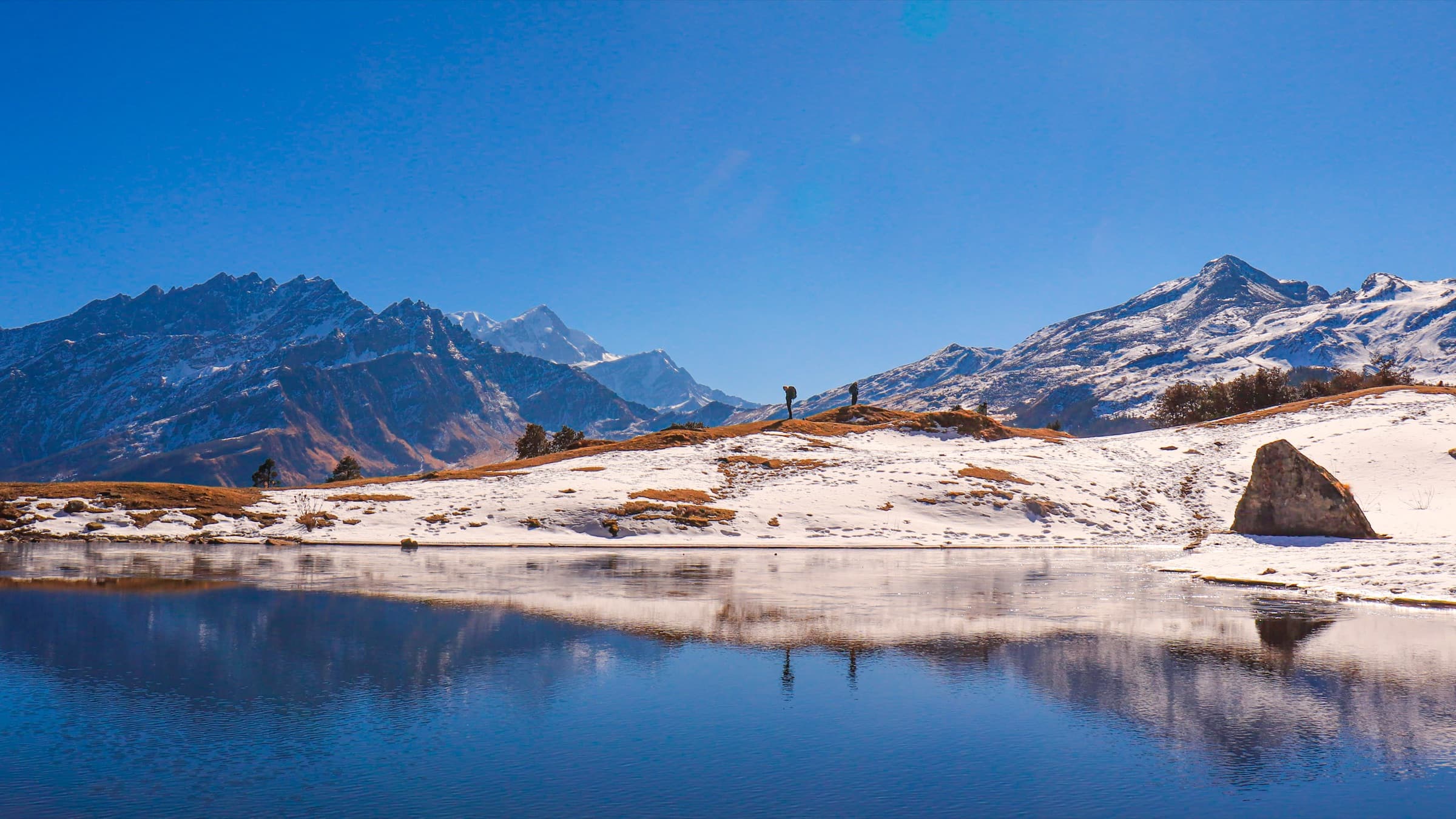
Overview
Kuari Pass is in the Nanda Devi National Park in the Uttarakhand district of Garhwal, India. Lush green forests and blooming pastures line the trek route, while the noticeable Nanda Devi, Dronagiri, and Chaukhamba peaks can be seen to the North. Joshimath is the closest town to the place where the trek begins. It serves as a base for different treks in the Himalayas and lies on an all-weather road connecting Rishikesh and Haridwar.
Why You'll Love This Trek
Trail Highlights
- 270-degree views of up to 22 Himalayan peaks
- Sightings of Nanda Devi & Dronagiri
- Sweeping alpine meadow at Gorson Bugyal
- Historic Curzon Trail route
- Dense oak & rhododendron forests
- Moderate difficulty, achievable for prepared beginners
What Makes This Trek Special
Kuari Pass puts you face-to-face with some of India's biggest mountains without demanding a technical climb to get there. Named the Curzon Trail after the Viceroy who once popularised it, the route winds through oak forests and open bugyals before opening up to a 270-degree view of up to 22 Himalayan peaks, Nanda Devi chief among them. It's a trek that manages to feel both grand and approachable: history, meadows, and mountains all in one walk.
Read MoreRead Less
Kuari Pass sits inside Nanda Devi National Park in the Chamoli district of Garhwal, Uttarakhand. The trek starts from Joshimath, a well-connected hub for trekkers and pilgrims, and moves through oak and rhododendron forests, alpine meadows, and ridgelines with constant mountain views.
Rated moderate, the difficulty comes from a steep first-day ascent, a narrow overhanging trail near Gorson Bugyal, and some navigational challenges in foggy conditions rather than any single extreme stretch. The reward is proportional — trekkers get views of Nanda Devi (25,673 ft), Dronagiri (23,182 ft), Chaukhamba, and Trishul, along with the sweeping meadow of Gorson Bugyal.
The trek is walkable most of the year except during the July–August monsoon, with winter (Dec–Mar) transforming the landscape into snow-covered forests and trails, while spring brings blooming rhododendrons and autumn offers golden meadows under clear skies. An optional extension to Pangarchulla Peak (15,096 ft) is available for those wanting a tougher summit challenge.
Route Map
Trailhead Weather
7-day forecastLive conditions at the trailhead. Plan around the forecast — mountain weather shifts fast.
Itinerary 6 Days
Day 1Rishikesh to Karchi
A scenic drive along the Panch Prayag route: Devprayag, Rudraprayag, Karnaprayag, Nandaprayag, and Vishnuprayag with Mt. Dronagiri coming into view as you near Karchi, your base camp for the trek.
Day 2Karchi to Akhrotghetta
The trek begins with a mix of gradual and steep sections through pine, oak, and maple forest, with views of Mt. Dronagiri and Karchi village along the way. The day ends at Akhrotghetta, a clearing marked by a lone walnut tree with panoramic mountain views.
Day 3Akhrotghetta to Khullara
A gentle, steady ascent through golden oak and rhododendron forest. The trail opens up as you near Khullara, where the receding treeline reveals wide views of the Garhwal Himalayan range, best seen at sunset when the peaks turn shades of pink and orange.
Day 4Khullara to Tali via Kuari Pass
The highlight of the trek, a steep initial climb to a ridge with 360-degree Himalayan views, followed by the push to Kuari Top for a panorama of up to 22 peaks. The trail then descends through Chitrakantha meadows and dense forest before reaching the Tali campsite.
Day 5Tali to Auli, drive to Dhak
A day of varied terrain: past Tali Lake, along a cliff-hugging trail, and through the expansive Gorson Bugyal meadow, before descending through Padiyar's oak forests to Auli. From there, a scenic drive takes you to Dhak for the night.
Day 6Joshimath to Rishikesh
The return drive retraces the Panch Prayag route back to Rishikesh, arriving by evening.
Best Time to Visit
Things to Carry
- Headlamp with spare batteries, sun hat/warm cap, polarised sunglasses, buff or balaclava
- Layered clothing (3–5 layers depending on season): wool sweater, fleece, padded/down jacket, thermals
- 3 quick-dry T-shirts, 2 pairs trekking pants
- Warm gloves, raincoat or poncho with backpack cover
- Waterproof trekking shoes with ankle support, sandals for camp
- 3–4 pairs wool/synthetic trekking socks
- Trekking pole, head torch, power bank, 1L water bottle
- Basic first-aid kit: antiseptic wipes, bandages, pain relief, ORS, Diamox (as advised)
- Sunscreen, lip balm, quick-dry towel, toiletries
Permits & Fees
Safety Tips
- Take the first day slow - the steep initial climb gains altitude fast, so pace yourself to avoid AMS.
- Watch your footing near Tali and Gorson - the narrow, overhanging trail gets slippery in winter or rain.
- Carry a map or guide for foggy stretches - the Padiyar to Gorson Tali section can be hard to navigate in low visibility.
- Know the signs of AMS - headache, dizziness, nausea. Tell your trek leader immediately if symptoms appear.
- Inform someone of your plans in advance - network coverage is minimal to non-existent for most of the trek.
- Dress for sudden weather shifts - carry proper layers and rain gear regardless of season.
Reviews
Write a ReviewNo reviews yet. Be the first to share your experience on this trek.