
Overview
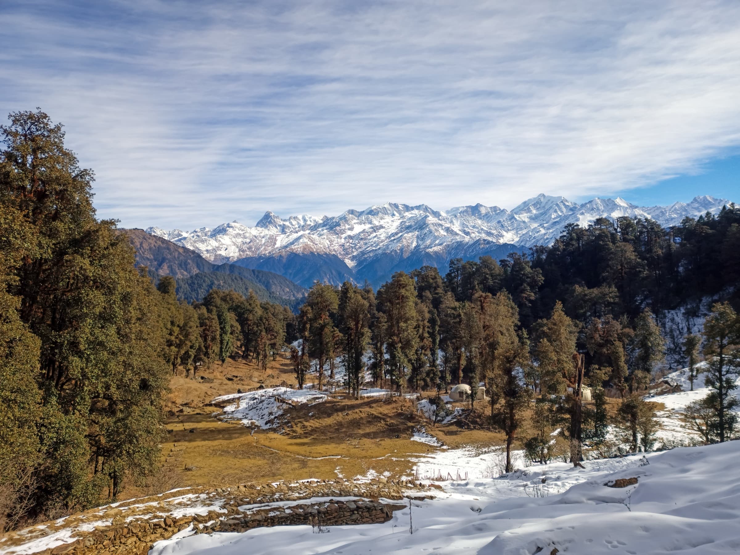
Dayara Bugyal is located in the Uttarkashi district of Uttarakhand, India, in the Garhwal Himalayas. It is approximately 11,800 feet (3,600 meters) above sea level. Another attractive feature of this region is the large grassy meadows, which command the best views of the snow-capped Peak Man and the majestic Bandarpoonch, Kala Nag, and Srikanth Mahadev towering over the horizon. The trek typically begins from the small village of Raithal or Barsu, accessible from Dehradun or Haridwar.
Why You'll Love This Trek
Trail Highlights
- Panoramic views of Bandarpoonch, Kala Nag & the Gangotri range
- Two serene high-altitude lakes : Gui & Barnala Tal
- Vast rolling meadows at Dayara Top
- Beginner-friendly, one of the easiest high-altitude treks
- Dense oak & rhododendron forests
- Great for families, first-timers & older trekkers
What Makes This Trek Special
Dayara Bugyal is proof that a trek doesn't need to be extreme to be unforgettable. The meadows here feel almost too perfectly arranged, framed by some of Garhwal's biggest peaks, Bandarpoonch, Kala Nag, and the Gangotri range all in view at once. It's one of the gentlest high-altitude treks around, yet it still delivers real mountain drama: sweeping sunsets, two quiet alpine lakes, and a landscape that transforms completely from winter snow to summer green. A trek that rewards far more than it demands.
Read MoreRead Less
Dayara Bugyal sits in the Uttarkashi district of Uttarakhand, in the Garhwal Himalayas, at around 11,800 ft above sea level. The trek usually begins from the small villages of Raithal or Barsu, both accessible from Dehradun or Haridwar.
It's considered one of the least demanding high-altitude treks above 11,000 ft, which makes it a favourite recommendation for beginners, families, and older trekkers easing into the activity. That said, two stretches do test your legs, the steep first kilometre out of base camp, and the final push to Dayara Top, which turns into a hard, frozen climb in winter.
The trek is walkable almost ten months of the year, skipping only the monsoon months. Each season brings something different: soft snow and snowball fights in winter, rhododendrons and wildflowers in spring, lush green meadows in summer, and golden, amber tones in autumn. Along the way, trekkers pass two high-altitude lakes: Gui Lake and Barnala Tal, and get views of peaks like Mt. Bandarpoonch and Gangotri I from Dayara Top itself.
Route Map
Trailhead Weather
7-day forecastLive conditions at the trailhead. Plan around the forecast — mountain weather shifts fast.
Itinerary 6 Days
Day 1Dehradun to Raithal
A scenic drive from Dehradun through Mussoorie and Uttarkashi, with a stop at Tingling Point for views of the Garhwal Himalayan range. You'll reach Raithal by evening, in time to catch the sunset lighting up the peaks around your base camp.
Day 2Raithal to Gui
A gentle, gradual climb through oak forest, with growing views of Mt. Srikanth and the Gangotri massif as you gain altitude. The trail passes a small water point before reaching the tranquil, forest-ringed campsite at Gui, where you can catch a stunning lakeside sunset.
Day 3Gui to Chilapada
A short, easy day through Gui Thatch meadow, past shepherd huts and distinctive igloo-shaped forest department structures. This stretch offers some of the trek's best photo opportunities, with views of the Gangotri range, Jaonli peak, and your first sighting of Bandarpoonch.
Day 4Chilapada to Nayata via Dayara Top
The main event, a walk across the wide-open meadows of Dayara Bugyal, framed by Bandarpoonch and the Gangotri range. Spend a few hours soaking in the views before descending through forest to Nayata.
Day 5Nayata to Raithal
A pleasant descent through dense forest canopy, with a stop at a grassy clearing for water and rest. You'll catch your last views of Bandarpoonch before arriving back at Raithal, completing the trekking circuit.
Day 6Raithal to Dehradun
The return drive retraces your route, crossing the Tehri Dam and stopping again at Tingling Point, arriving back in Dehradun by evening.
Best Time to Visit
Things to Carry
- Warm cap/hat, headlamp with spare batteries, UV-protection sunglasses, buff or balaclava
- Layered clothing: woolen sweater, fleece jacket, padded/down jacket (add layers for winter)
- 3 quick-dry T-shirts, 2–3 pairs trekking pants, 2 pairs thermals
- Insulated gloves, rain poncho or raincoat with backpack cover
- Waterproof trekking shoes with ankle support, sandals for camp/streams
- 3–4 pairs moisture-wicking trekking socks
- Trekking poles, power bank, waterproof bag for electronics, 1L water bottle
- Basic first-aid kit: antiseptic wipes, bandages, pain relief, ORS, Diamox (as advised by a doctor)
- Sunscreen, lip balm, quick-dry towel, toiletries
Permits & Fees
Safety Tips
- Acclimatize first - spend a day in Raithal before starting; altitude sickness is possible even on easier treks.
- Watch for AMS symptoms - headache, nausea, dizziness, fatigue. Rest, hydrate, descend if it doesn't improve.
- Carry a first-aid kit - include Diamox and other basics for altitude sickness.
- Share your itinerary - inform someone outside the group, with an emergency contact.
- Dress for sudden weather shifts - layered, windproof, waterproof clothing, even in summer.
- Avoid the monsoon months - July–September trails get slippery with landslide risk.
- Carry rain gear - poncho or raincoat plus waterproof trekking boots.
Reviews
Write a ReviewNo reviews yet. Be the first to share your experience on this trek.