
Kashmir Great Lakes Trek
Overview
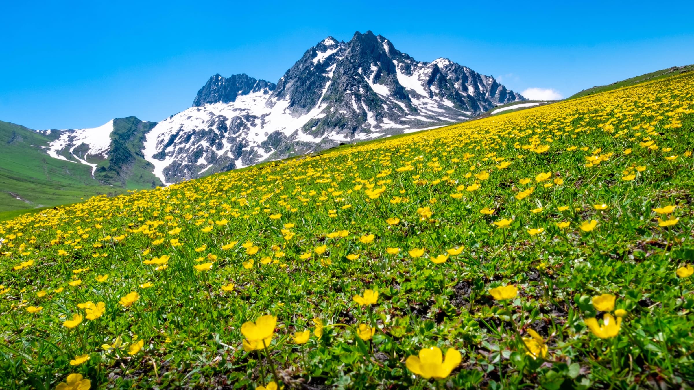
Kashmir Great Lakes is undoubtedly one of the most breathtakingly beautiful treks in the Indian subcontinent, and this expedition is true to the phrase “Kashmir is heaven on earth.” The route is in a picture-perfect landscape just barely 75 km northeast of Srinagar and has pipelines cutting across imposing peaks, rolling hills, and crystal-clear lakes. Wild, rugged mountains, rolling green meadows, and turquoise-colored alpine lakes are all present on the trek. You'll encounter more than six beautiful lakes and five uniquely different valleys to explore!
Why You'll Love This Trek
Trail Highlights
- Six stunning alpine lakes on one trek
- Views of Mount Harmukh from Gangbal Lake
- Crossing three high-altitude passes
- Twin-lake view from Gadsar Pass
- One of India's longest and most scenic treks
- Encounters with local Bakarwal shepherds
What Makes This Trek Special
A week-long journey through some of the most dramatic alpine scenery in India — glacier-blue lakes, wide open meadows, and three high mountain passes, culminating at the sacred Gangbal Lake beneath Mount Harmukh.
Read MoreRead Less
The Kashmir Great Lakes Trek is in the breathtaking Kashmir Valley, known for its stunning landscapes, alpine lakes, and majestic mountains. The trek primarily occurs in the Ganderbal district of Jammu and Kashmir, India.
The Kashmir Great Lakes are situated at an altitude of 13,715 meters, and for this, we classify Kashmir Great Lakes treks as moderate in terms of reliability to difficulty. This rating implies that you will encounter long trekking days that have difficulty in steep climbs. Yes, while the trek rewards you with breathtaking views of meadows and lakes, it is endless.
You will walk approximately 75 km in 6 days or about 12 km every day of trekking. Adding altitude to the walking distance makes this trek even more strenuous – every day, you will go up and down an average of around 1500 feet.
The best window to attempt this trek is from early July to mid-September, once the high passes clear of heavy snow. Along the way, trekkers often cross paths with local Bakarwal shepherds grazing their flocks in the high meadows, adding a cultural layer to an already spectacular trek.
Route Map
Trailhead Weather
7-day forecastLive conditions at the trailhead. Plan around the forecast — mountain weather shifts fast.
Itinerary 8 Days
Day 1Drive from Srinagar to Sonamarg
A scenic drive out of Srinagar into the mountains, with your trek briefing and gear check happening once you reach the starting point near Sonamarg.
Day 2Trek to Nichnai
The trek kicks off with a steep climb along the Sindh River before easing into maple forest and open meadows. You'll pass through the pretty Shekdur meadow before dropping into the wide Nichnai Valley, where you camp for the night.
Day 3Nichnai to Vishansar via Nichnai Pass
A gradual climb along the river leads up to Nichnai Pass at 13,229 ft, one of the last spots with mobile network on the trek. The descent takes you past a waterfall and through flower-filled meadows before reaching your campsite near Vishansar Lake, which is worth the short detour to see up close.
Day 4Vishansar to Gadsar via Gadsar Pass
The trek's biggest day, a steep climb rewards you with a view of the twin Krishansar and Vishansar lakes before topping out at Gadsar Pass (13,715 ft), the highest point of the trek. The descent passes Yamsar Lake and drops you into camp beside the stunning Gadsar Lake.
Day 5Gadsar to Satsar
A shorter day, but still involves a steep initial climb before levelling into rocky, high-altitude terrain. You'll pass through an army checkpost before reaching the first of the Satsar lakes, where you camp for the night.
Day 6Satsar to Gangbal via Zaj Pass
One of the toughest days on the trek, constant ups and downs, a boulder-hopping stretch, and a climb over Zaj Pass (13,276 ft) before descending to the twin lakes of Gangbal and Nandkol, set beneath the towering Mount Harmukh.
Day 7Gangbal to Naranag, Drive to Srinagar
A long descent through pine forest brings you down to the village of Naranag, from where you drive back to Srinagar, arriving by early evening.
Day 8Buffer Day
Kept aside for weather delays or unexpected hold-ups; if unused, it's a good day for extra sightseeing in Srinagar.
Best Time to Visit
Things to Carry
- 50–60L backpack with rain cover + 20–30L day pack
- Trekking pole
- Two 1L water bottles or a hydration pack
- Lightweight tiffin box, energy bars, dry fruits, ORS
- Quick-dry synthetic T-shirts, fleece T-shirt, thermal inners
- Wind-stopper/fleece jacket, padded/down jacket, poncho or rain jacket
- 3 pairs quick-dry trek pants
- Fleece or woolen gloves (waterproof exterior preferred)
- Head torch with spare batteries
- Woolen cap or balaclava, buff/neck gaiter, UV-protection sunglasses, sun cap with flaps
- Waterproof, ankle-support trekking shoes + camp footwear (sandals/floaters)
- 7 pairs cotton socks + 1 pair woolen socks
- Gaiters and microspikes
- Sunscreen, moisturizer, lip balm, toiletries
- Personal medical kit (consult trek leader before use): Diamox, Dolo 650, Avomine, Combiflam, Digene, ORS, optional knee brace
Permits & Fees
Safety Tips
- Share your plan — let someone know your route and expected timings before you set off; network coverage disappears for long stretches between Nichnai Pass and Naranag.
- Respect the altitude — the trek touches nearly 14,000 ft, so climb gradually and don't ignore headaches, nausea, or dizziness. If symptoms don't ease, turn back rather than push on.
- Watch the weather — conditions in the high passes can shift fast, especially around Gadsar and Zaj Pass, turning a straightforward crossing into a risky one.
- Treat your water — refill from streams along the way, but carry purification tablets or a filter, since natural sources can't be assumed safe.
- Layer up and break in your boots — daytime warmth can flip to biting cold within hours, and worn-in, ankle-supporting shoes make a real difference on the boulder sections.
- Don't trek this one solo — go with an experienced guide or a registered group; several stretches have no easy exit points if something goes wrong.
- Reaching Naranag by 4 PM matters — the checkpost closes then, and missing it can mean an unplanned night out with limited support nearby.
- Pack the essentials — first-aid kit, torch, power bank, and emergency numbers saved offline, since charging points and signal are scarce for most of the trek.
