
Broad Peak Avalanche 2026: What Happened to Nimsdai and the Nine Climbers Who Died in Pakistan?
An avalanche on Broad Peak on 30 July 2026 killed ten climbers, including Nirmal “Nimsdai” Purja. What is known about the slide between Camps 2 and 3, who the ten were, and what the recovery has established so far.

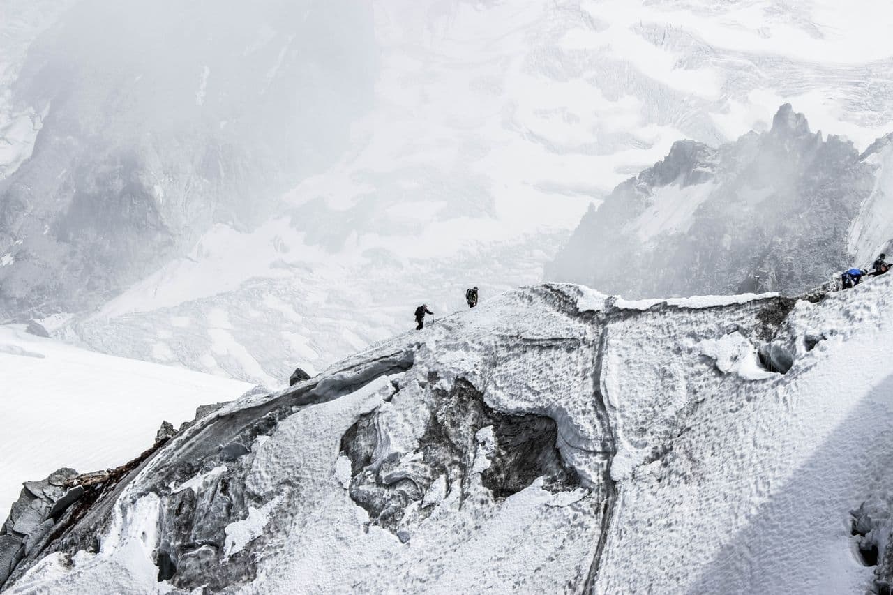
The Broad Peak looked as usual calm from below on the morning of 30 July 2026. However, after a few minutes everything changed. There was a massive avalanche that tore across the upper slopes of the mountain. The worst part is that it swept away 10 climbers who were on their way to the higher camps. It was within a matter of a few minutes that an international team vanished into the ice, snow and rock. People who were watching from the lower camps had nothing to do. Nature had already decided their fate, and nobody could help.
The Broad Peak rises to 8051 m in the Karakoram range of Pakistan. It is one of the most popular peaks and the 12th highest mountain in the world. It is never new to welcome the mountains, as every climbing season brings tons of mountain years every year. They have a shared goal, which is to stand on the summit and breathe the breathtaking nature from the top. Similarly, they also accept the dangers that come with its extremity.
Early reports placed the avalanche between Camps 2 and 3. It has been reported that the slide struck near 6600 m. This is the section of the normal climbing route. It remains exposed to steep snow slopes and the ever-changing mountain conditions. It was later that the tracking data suggested that several climbers fell hundreds of metres after the avalanche struck.
Those climbers came from different nations. They were representing Pakistan, Nepal, Oman, China, and the United States. Some of them were working as professional guides, and others were expedition members or clients. As the report says, different climbing teams moved together during the final weather window. However, the available evidence has not yet confirmed that all 10 belong to one expedition.
Rescuers have made ample search work despite the difficult conditions. Drones, helicopters and ground teams equally joined the effort. However, hope slowly faded as they gathered more evidence. Officials eventually confirmed the worst outcome. No one from the group survived.
The tragedy is more than just losing one famous climber. It claimed experienced guides, lifelong dreams, and ambitious mountaineers. It equally raised some of the most difficult questions. What exactly happened that morning? Did anybody ever see that the danger was coming? These answers need proper reconstruction of the routes, understanding more about the weather and its intricacies, and the final hours before the avalanche.
Key facts of the Broad Peak avalanche
These are the following facts that clearly reflect verified information available. However, some of the details might change as official investigations continue.
| Detail | |
|---|---|
| Current verified information Date | 30 July 2026 |
| Location | Broad Peak, Karakoram, Gilgit-Baltistan, Pakistan |
| Mountain height | Approximately 8,047–8,051 metres, depending on the source |
| Reported avalanche zone | Between Camps 2 and 3 |
| Approximate elevation | Around 6,600 metres |
| Climbers affected | 10 |
| Reported fatalities | 10 |
| Expedition stage | Summit push |
| Rescue challenges | Severe weather, unstable snow, extreme altitude, and difficult helicopter access |
Editorial update: 4 August 2026
The Broad Peak avalanche is considered one of the deadliest climbing disasters in the Karokaram in recent years. The slide struck in the final summit window of the season. Climbers from different expeditions were moving up together when it struck. However, reports do not yet confirm that they all belong to one expedition.
Different official details are still under review. Different sources report that the elevation of Broad Peak is 8047 or 8051 m. This difference clearly reflects the separate survey methods and the published references. The location is consistently reported as the section between Camps 2 and 3 at roughly 6,600 m.
- Rescue operations also faced immediate obstacles.
- Heavy snowfall had reduced visibility.
- Avalanche risk also threatened rescue teams
- Thin air reduced movement above 6000 m
- Helicopters were struggling due to the altitude and weather
- Ground teams worked across steep and unstable terrain
Most crews were using helicopters, experienced climbers, drones and support from local teams. Initial operations focused on locating survivors. However, later the mission shifted completely towards recovery after the evidence indicated that there were no survivors. Expedition operators and authorities also confirmed that they have lost all 10 climbers.
What actually happened?
A reconstructive timeline
- Late July snowfall
- Teams prepare for the final summit window
- Climbers leave higher camps before dawn
- Avalanche strikes between Camps 2 and 3
- Tracker data shows sudden uncontrolled descents
- Communication stops
- Search begins with drones and ground teams
- Bodies recovered over several days
- Authorities confirm ten fatalities
The following timeline is a combination of verified reports, official statements and published accounts. However, timings are still under investigation.
Before 30 July 2026
Late July
The Broad Peak summit was covered with fresh snowfall during the final climbing weeks. Teams have meticulously watched weather forecasts closely before they were moving higher. Snow stability was always a concern across the upper mountain region.
Different expeditions stayed on Broad Peak after the earlier Summit attempts. Others already left the mountains. Those remaining were hoping for one final opportunity before the conditions got worse.
Rope fixing teams were already prepared for the normal climbing routes. All the camps were stocked with fuel, food and oxygen. The climbers gradually started moving from the base camp towards the higher camp.
Forecasts equally suggested that there was a short improvement in weather. Many teams equally believed that it offered the last realistic summit window of the season. Waiting longer could have carried greater risk from fresh snowfall and unstable conditions.
Nirmal Purja reportedly added Broad Peak to his wider Karakoram climbing plans. He was joining other experienced climbers and preparing for the summit push. Reports have indicated that several expeditions travel together in the weather window.
Morning 30 July 2026
Early morning
Climbers started for the higher camps before daylight. The final goal was to reach the summit within stable conditions. It follows normal high altitude climbing practice.
Different teams climbed the same routes between camp 2 and 3. The terrain was steep snow slopes and several exposed sections. Weather was equally suitable during climbing.
Around 9 to 9:30 AM ( as per the reports)
There are some published reports that say the avalanche took place during this period. Tracker data also showed that several climbers were making sudden and uncontrolled descent. Those movements suggested that they might have been swept away rather than climbing abnormally. The tracker information has not been clearly explained by the official investigation.
Around midday
Early reports from the Pakistani officials and Reuters placed the avalanche around midday. However, later they suggested that the event might have happened earlier. Authorities have not yet released the final verified minute-by-minute timeline.
The avalanche struck between camps 2 and 3. Reports have placed the location near 6600 m, where 10 Climbers immediately disappeared within a matter of a few seconds.
After the avalanche
Communication with climbers suddenly stopped. Teams below soon realised that something might have gone wrong. Attempts to establish radio contact did not receive any response.
Base camp immediately organised visual checks from the lower positions. Climbers were looking at the higher slopes using binoculars and other available equipment. Reports of the incident soon reached the Pakistani authorities and the Alpine Club of Pakistan.
Poor weather complicated even the rescue decision. Cloud was everywhere, which limited visibility; fresh snow increased the danger of avalanche, and helicopters were not able to safely reach the accident site immediately.
Drone flights were later used to search the avalanche area. Images showed signs of multiple victims across the debris field. Ground teams also started climbing from the base camp and Camp 1, even when there were difficult conditions.
31st July to 2nd August
31st July:
Search teams found the first bodies from the mountains. The footage taken from drones clearly indicated several more victims remain in the avalanche zone. Recovery efforts continued whenever the weather allowed.
1st August
Poor weather was delaying the operations. Helicopters were facing severe altitude limits and the ever-changing mountain conditions. Ground rescuers carefully advanced through stable snow. Additional Nepali and Pakistani personnel supported the mission.
2nd August
Authorities confirmed that all 10 climbers were lost on their way to the summit. Recovery teams continued identifying victims before they were transferred whenever conditions allowed. Families, expedition operators, and climbing organisations received official notifications.
Who Were the Ten Climbers?
The avalanche that took place on the Broad Peak took the lives of 10 climbers on 30 July 2026. The peak is 8,047 m tall and situated in the Karakoram range of Pakistan. Five different countries have lost their citizens in the tragic event. The climbing members that we have lost include some of the most famous mountaineers and veteran high-altitude guides. Disasters like this clearly show the extreme risk and the unpredictable nature of 8,000 m mountains.
Here are the updated report details of every life lost during the expedition. The official announcements were made by the Alpine Club of Pakistan, Elite Exped, and news outlets like CBC News and The Times of India confirm these facts.
Nirmal “Nimsdai” Purja:
- Nationality: Nepali-born British
- Role: Expedition leader
Nirmal Purja is a very famous name when it comes to mountaineering. He was popularly known by the name Nimsdai. It has been reported that he was 43 years old when he lost his life. Purja grew up in Nepal and served 16 years in the British military. He joined the Brigade of Gurkhas first, and then joined the Special Boat Service.
Purja received international fame in the year 2019. It has been reported that he has climbed all 14 8,000 m peaks in 189 days. It is a legendary move by a human. The documentary 14 Peaks Chronicles was a record-breaking project. The famous Netflix documentary “14 Peaks: Nothing Is Impossible” was based on Nimsdai Purja's unbelievable achievements. At the time of his death, he was attempting to become the first person to climb all fourteen 8,000 m peaks without supplementary oxygen. He also made the first winter ascent of K2 in 2021.
Purja went for his last attempt on Broad Peak after climbing Gasherbrum II. This was because he was willing to climb all 14 peaks twice. The avalanche and the unpredictable nature took away his team down to the slopes on 30th July. Rescuers have already located his body. However, his legacy continues through the mountaineering foundations and record-breaking achievements.
Nima Sherpa:
- Nationality: Nepal
- Role: High altitude guide
Nima Sherpa was working as a guide for Elite Exped. He was someone who had years of experience climbing at extreme altitude in the Himalayas. He guided several clients through deadly terrain by maintaining the utmost safety.
Nima Sherpa joined Purja for the Broad Peak attempt. In the final weather window, he and his team pushed toward the summit. He was known for his calm decision-making under pressure. The climbing community deeply mourned this massive loss.
Pur Bahadur “Yukta” Gurung:
- Nationality: Nepal
- Role: High altitude guide
Pur Bahadur Gurung was popularly known in the community as Yukta. He has gained great respect across Nepal for his amazing climbing skills. He was one of the guides who had already guided some of the most popular international teams across the high Asian ranges.
He was climbing alongside Nirmal Purja in the Broad Peak push. The avalanche that suddenly showed up took away the team between high camps. Rescuers have already recovered his body very early in the search operations. He was popular among his friends and family for his discipline, humility, and technical expertise.
Kili Pemba Sherpa:
- Nationality: Nepal
- Role: High altitude guide
Kili Pemba Sherpa was another person who lost his life in the avalanche. He was popular as Kilu. In his career, he devoted himself to supporting high-altitude expeditions. He was an important part of the team as he played roles that ensured safety. He fixed ropes, kept clients safe and managed supplies.
He also joined the brought peak summit attempt along with his fellow members. The extreme hazard took his life and his dream. The global mountaineering fraternity has always honoured his extreme courage and dedication.
Nawang Thindu Sherpa:
- Nationality: Nepal
- Role: High altitude guide
Even though early news published different spellings for his name, officials now confirm his identity properly. He was someone who built a quiet career on the highest peak of the world.
Nawang was a quiet hero who was tirelessly working behind the scenes on the major peaks. His work helped international climbers to easily achieve their goals. The sudden death was a shock to the Sherpa community in Nepal.
Gyalu Sherpa:
- Nationality: Nepal
- Role: High altitude guide
Gyalu Sherpa was known for his physical endurance when it comes to extreme climbing experience. He had already worked on different Himalayan peaks and was known for his stellar achievements. He joined the Broad Peak team for the final push.
The lives of Sherpa guides are always at risk on every expedition. Gyalu was known for his steady discipline and quiet focus. Teammates remember him for his constant willingness to help others.
Sohail Sakhi:
- Nationality: Pakistan
- Role: Mountain guide and photographer
Sohail Sakhi was another top high-altitude professional. He was from Pakistan. He was working as a guide, photographer and geographer. He was someone who had great knowledge of the Karakoram terrain intimately.
He was assisting the team on his home mountains. He never knew that peak was his final expedition. He shared the beauty of peaks in Pakistan with the world. Local authorities and foreign climbers honoured the generous spirit.
Nadhira Al Harthy:
- Nationality: Oman
- Role: Independent climber
Nadhira Al Harthy was from the Arab world, and she was a female climber who had great previous experiences. She went to Mount Everest, Nanga Parbat, and K2. She was an inspiration for the women's community across the Middle East, who pursued adventure as a full-time role.
Al Harthy was aiming to complete Broad Peak as the next milestone. Unfortunately, the avalanche took her life and her ambitious climbing journey. Rescuers recovered her body and flew it to Islamabad. Oman clearly mourns her historic contribution to sport.
Sarah Mallory Geis:
- Nationality: United States
- Role: Independent Climber
Sarah Mallory Geis was from the United States. Friends and family called her Mallory. The Broad Peak expedition was her very first 8000 m attempt in the land of Pakistan.
She had a strong passion for exploring high mountain places. She was training hard to be able to endure the physical demands required for Karakoram peaks. Search teams recovered her body, which was later taken to Skardu. Her family remembers her bright light and curious spirit.
Wang Zhong:
- Nationality: China
- Role: Independent climber
Wang Zhong was joining the international team for the final summit journey. He had the goal of safely moving to the Broad Peak summit. Chinese authorities clearly monitored the recovery efforts closely after the disaster happened.
He showed huge dedication to high-altitude mountaineering. His death completed all the 10 members lost in the avalanche. The global climbing community grieved every single loss.
The 30th July avalanche clearly destroyed hopes and left many lives in a matter of a few seconds. Operations involved a military helicopter and ground team. However, the unstable snow and weather conditions became an obstacle in the initial recovery tasks. The tragedy clearly reminds us that the mountain holds total power. There is nothing beyond nature.
The 10 climbers came from different cultures and countries, but shared the same passion for wild places and extreme heights. Their stories will permanently remain associated with Broad Peak.
Why Was Nimsdai Climbing Broad Peak?
Nirmal "Nimsdai" Purja visited Pakistan with the ambitious objective. He was not chasing publicity, but he was pursuing a historic personal milestone.
The 2026 expedition was something that he called the hat trick project. His goal was not just climbing a single mountain. He was aiming to be the first person to climb all 14 world’s 8000m peaks three times. It was a part of his Hat-Trick project. As he wanted to add a new difficulty to this challenge, he aimed to climb the Pakistan peaks without the need for supplementary oxygen. Elite Exped clearly describes the project as his major next chapter.
Before he added Broad Peak to his plans, the objective focused on Gasherbrum II. He was able to reach the 8,035 m summit. The climb showed another step in the new project. It also showed that he had excellent climbing form to take on the Hat-Trick project.
He added Broad Peak later into the expedition schedule. Elite Exped explained it as a choice that was made due to favourable weather. Climbers mostly adjust when the natural conditions allow them to summit. Such decisions are common during the major Karakoram expedition. It depends heavily on team readiness, logistics, weather, and mountain conditions.
Adding Broad Peak to his list does not showcase reckless behaviour but a strategic decision. There was no official finding that links the decision with the avalanche. High-altitude expeditions mostly adapt their objectives when there are safe opportunities. Investigators never blamed the change of itinerary for the disaster.
A successful ascent to Broad Peak provides a deep personal significance. It would leave Cho Oyu as the final peak. Reaching that stage gave him another remarkable achievement.
This project showcases the overall philosophy of Purja. He accepted challenges throughout his career when it comes to high-altitude climbing. His earlier Project Possible showcased speed records. The oxygen-free achievement raised the standards, and the hat trick project continued the same pursuit. It showcased endurance, consistent performance, and technical ability across the major peaks of the world.
For Nirmal Purja, Broad Peak was not just another summit. It was as important a milestone as any other. Tragically, the journey ended before he reached the summit. The avalanche took the lives of nine other climbers with him.
Understanding Broad Peak
Nature is beautiful, but it comes with unique challenges. Broad Peak is situated inside the Karakoram mountain range of Pakistan. It also sits along the border between China and Pakistan. The massive peak rises to 8051 m above sea level. Its elevation makes it the 12th highest peak on Earth.
Climbers mostly approach the mountain with the use of the famous Baltoro Glacier. It sits very close to K2. Only 8 km separates these two giants. Both of these peaks are known to have fierce winds and sudden snowstorms. Many teams have attempted both peaks during one Karakoram season.
Topography and peaks
Broad Peak gained its name from the vast summit ridge. The upper crest mostly stretches across 1 km. There are three main summits along the high ridge.
- The Main reaches 8,051 m.
- The central Broad Peak reaches about 8,011 m
- Broad Peak North is approximately 7490 m.
A true ascent is counted only when climbers reach the Main summit.
Climbers mostly make mistakes finding the real top. Reaching the Main summit would need traversing along the narrow Ridge.
The climbing route and camps
Most expeditions follow a standard West Ridge route. Climbers who have previously experienced established five primary stages of the mountain.
- The base camp sits at 4,900 m on the Godwin Austin glacier.
- Camp 1 is located at 6,000 m on steep snow conditions.
- Camp 2 is at 6,400 m on a rocky ledge.
- Camp 3 is at 7,100 m on the exposed ridge.
- The summit push starts from Camp 2, mostly before midnight.
Climbers who want to reach the summit spend weeks carrying equipment between these camps. The constant back-and-forth movement helps to adapt their bodies to the thin air. High altitude illness mostly strikes quickly without proper acclimatisation.
The tragic 2026 avalanche
There is a constant risk in high mountain ascent, even though you have made careful planning. 30 July 2026 was one of the examples. A massive avalanche suddenly struck Broad Peak. The slide was seen to occur between Camp 2 and Camp 3. The tracking data located the team near 6660 m.
All 10 climbers were killed in the expedition. It included renowned mountaineer Nirmal Purja, who lost his life in the tragedy. Five Nepali guides and foreign independent climbers died alongside. Rescuers equally faced extreme dangers while working at such high altitude and environmental conditions.
Environmental hazards
Avalanche is a permanent threat on the Karakoram slopes. Fresh snow creates an unstable snowpack quickly, and strong winds create heavy snow slabs above climbing lines. Additionally, with the rising daytime temperature, it weakens the ice layer underneath.
A tiny snow collapse can also trigger a massive slide. The area near 6600 m has steep snowfields underneath. The changing snow conditions would need constant caution from expedition guides.
Weather and altitude challenge
Weather on the Broad Peak can shift rapidly without any warning. The freezing winds constantly reduce visibility to 0 in a matter of a few minutes. The temperature on the upper slopes mostly drops far lower than freezing. So climbers need to wait for the narrow weather windows.
These clear periods mostly last for only two days. Multiple teams have shared these short windows to create high route traffic. No wonder that thin air reduces oxygen levels above 7000 m. Every step would need immense physical effort and mental focus.
Comparative difficulty and safety
Most guidebooks label Broad Peak as less technical compared to K2. This statement can be misleading information for inexperienced climbers. No wonder that Broad Peak has less steep rock climbing than K2, but the mountain remains extremely lethal.
Climbers have to face crevasses, sudden avalanches and severe frostbite. The long Summit Ridge can be exhausting even for the strongest of athletes. Fatigue is one of the reasons that impairs judgement in the critical descent phase. Most mountain accidents happen while descending from the top.
Rescue limits at high altitude
Rescue operations almost become impossible above 6000 m. Helicopters are unable to generate lift in such thin mountain air. The violent gusts prevent pilots from properly landing on a narrow ridge. The constant storm can ground search teams until it stabilises.
Ground teams would need huge teams of skilled high-altitude guides. When it is about moving an injured person downhill, it requires intense physical labour. Prevention, therefore, remains the best safety strategy.
Impact on the climbing community
The 2026 tragedy has clearly shocked the mountains across the world. Guides, fans and families have lost 10 brave climbers. The disaster highlighted the huge risk of climbing at extremely high altitudes. Eventually, your fate will be decided by the mountain, no matter how experienced or physically fit you are.
What may have triggered the avalanche?
This is one of the most common questions in mind now. However, what actually triggered a large mountain avalanche would require cautious scientific analysis. Most such events generally result from different factors that combine over time. Snow starts accumulating in different layers, and wind continuously reshapes those layers. Shifting temperatures change the overall strength, and eventually one human or natural event can release the entire slope.
Investigators have not yet identified what actually triggered the avalanche at Broad Peak. Rescue teams were focusing on locating victims rather than conducting an investigation. Therefore, the exact cause is still unknown. Recent wind loading and snowfall might have also contributed to creating such unsettling conditions. However, there are no official technical investigations that have mentioned the precise trigger of the avalanche.
Major factors under investigation
- Recent heavy snowfall: Different expeditions experienced poor weather before they made the final push to the summit. However, the heavy snowfall delayed their plans across the Karakoram. When heavy snow starts settling on steep slopes, its stability starts decreasing until the layers bond together. The process can take several days or hours. Most teams would leave the mountain after heavy, erratic snow, which might make slopes unstable.
- Wind loading: Strong wind is not just a factor to move loose snow. It also transports snow onto sheltered slopes and increases the weight of layers. Wind deposits snow much faster than falling snow. The dense wind slabs can feel natural or when they get added weight.
- New snow resting on the weak layers: Snow really creates one solid block. Every storm results in a new layer with different density. When heavy and fresh snow starts depositing on a weaker layer, it becomes deeply unstable. Avalanche researchers can identify it and consider it as one of the major causes of slab avalanches.
- Rapid temperature changes: Snow Bond can be altered by warmer daylight that comes after cold nights. Modest warming mostly reduces stability on these slopes, especially after fresh snow. Shifting temperature can also influence the overall condition significantly.
- Slope angle and solar exposure: Avalanches occur on the slope between 30 and 45°. The upper root of peak steep snowfields within that specific range. Wind, shade and sunlight can affect the way snow sets quickly or weakens during the daytime.
- Final weather window and climber presence: Many teams have been waiting for the same weather improvement before they attempt the final summit. Such windows mostly last only for one or two days. Multiple teams moved across similar terrain near 6600 m. Additional weight might have caused stress to the unstable snow path, but avalanches also release naturally without any human influence.
- Natural versus human-triggered release: Natural avalanches release without any direct human influence. Human-triggered avalanches occur due to added stress on the unstable layer. However, no official reports have been concluded on which category has triggered the July 30 disaster.
The Broadpeaks tragedy has now made it a stark reminder that avalanches do not have one simple explanation. Until qualified scientists or high-altitude guides complete the technical assessment, the major factor that triggered remains unknown. It is better to avoid claiming the team triggered the slide, as there is no verified evidence that supports the claim.
Did other expeditions turn back?
After the Broad Peak tragedy, one question has started emerging. Did the other climbers decide not to continue before the avalanche?
The answer seems to be yes. However, it requires careful interpretation. Different expectations, postponed or abandoned summit attempt before 30 July. But there has been no verified evidence about the reason for withdrawing.
Some teams chose to stay back
Climbers continuously face setbacks, especially during the days that lead to the summit window. Fresh snowfall generally covers the upper slopes, and poor visibility complicates the navigation above Camp 3. Teams have already encountered deep snow when they were establishing fixed ropes.
Madison Mountaineering has reported that the team turned back after they reached the higher camp. Expedition leader Sylvester cited stormy Weather, tough terrain, and low visibility. The team decided to safely return to camp and reassess conditions. He did not mention an imminent avalanche hazard. Other expeditions delayed Summit plans as they were waiting for clear skies. These causes reflect the common high altitude decision-making rather than having a specific disaster forecast.
Why did teams withdraw?
There can be several reasons why teams and their leaders withdraw from the final summit. However, these are some of the most common conditions that lead teams to withdraw a plan.
- Fresh snowfall that creates difficult trail-breaking conditions.
- Dense clouds at higher altitudes reduce visibility
- Deep snow can slow the progress above Camp 3.
- It makes it challenging for the leaders to make route-finding decisions.
- Teams wait for a better weather window.
However, none of these reports can state that leaders would have predicted the avalanche on 30th July.
Were warnings shared?
There has been no official investigation that confirms the avalanche warning has reached the affected climbers directly. Similarly, no verified report also shows that a team advised another to turn back. Weather forecasts circulated among teams but differ from slope-specific avalanche assessment. There has been no public evidence that shows independent forecasters who examine upper snow before it happens. High-altitude expeditions mostly rely on weather forecasts, direct observation and local experience. Detailed snow stability remains extremely rare above 6000 m.
Did the group coordinate?
Reports show that four groups were active in the final summit window. It includes Elite Exped, Imagine Nepal, Seven Summit Treks, and a Pakistani-American team. They are sharing a portion of the standard route when they found the window. However, sharing a similar route does not mean that they would share every operational decision. Each expedition has its own individual decision-making about when to leave camp and when to turn back. Those choices are independent and are based on team condition, mountain, hazards, and logistics.
Who made the final decision?
No official report could identify a single person responsible for making the final decision. This is an unanswered question. Investigation might clarify how leaders assess the conditions during the final push. Until then, claiming anyone remains inaccurate. Available evidence does not give a clear conclusion.
Tracker Data: What It Shows and What It Cannot Show?
Satellite trackers like Garmin inReach devices are very common when it comes to high-altitude expeditions. These devices help climbers to share location data and request emergency help. During the disaster, the tracker records provided some clues. However, these records contain technical limitations.
What does a Garmin inReach record?
This device generally records users' GPS position at selected intervals. The positions are uploaded every few minutes or at long intervals. Most climbers set automated tracking, while others upload positions manually. Every recorded point includes elevation, coordinates, time and travelling direction. The device creates distinct points instead of a continuous line. Investigators can interpret movement between those positions.
How does GPS reveal a sudden descent?
Normal climbing in the GPS shows steady movement up or down the mountain. However, a rapid drop in elevation clearly indicates an uncontrolled fall. Published tracking data from Broad Peak clearly show that the climber started falling hundreds of metres quickly. As the tracker recorded by Nirmal Purja, there was a sudden drop of roughly 800 m. Nadhira Al Harthy's device also showed a steeper vertical drop. These movements showcase an involuntary fall, which can be caused by an avalanche. Search teams mostly use these signals to locate the debris field.
What can tracker data tell investigators?
The GPS records can help investigators reconstruct the general climber movement.
- It shows where the upward progress has stopped.
- The map shows fall paths across steep terrain.
- It helps to compare movements between team members.
- It can guide the search and recovery teams to directly find the key coordinates.
What the data cannot prove?
GPS tracking also has its limitations. It will not be able to explain why the accident occurred.
- It cannot find the actual reason for the avalanche.
- It cannot show whether the slide was human-triggered or natural.
- It cannot reveal team conversation or decision before the event occurred.
- It cannot measure snow stability beneath the surface.
- It won’t determine the precise moment of death.
Minor movement after a fall can show equipment shifting. Signal interference in high mountains can also sometimes cause small locations. A tracker records where a person has travelled, not what they have experienced.
Responsibly using tracker images
Publishers need to handle satellite tracking images with proper care and responsibilities. Good editorial practice requires getting permission before they share private tracking data. Editors need to remove any account numbers or personal contact information. Captions need to state that the display path remains approximate. Explaining gaps would prevent misunderstanding and rumours.
The delay alarm and rescue response
Timing is one of the hardest questions after the Broad Peak tragedy. How long did it take before the emergency became clear? Was it possible for rescuers to reach climbers sooner? These questions need careful examination. Many operational details are still under official investigation.
An emergency at 8000 m really gives no prior notice. Communication mostly relies on radio, satellite devices and weather conditions. These systems fail within seconds when a massive avalanche strikes.
When was communication first lost?
Public reports clearly indicate that communication was lost with the affected groups after the avalanche. This is when the base camp teams understood that something was wrong when the expected check-in failed. However, authorities have not yet released the exact minute-by-minute communication log.
Several modern expeditions use satellite tracking devices. These devices can help family members and staff to monitor progress. Published tracker data later showed uncontrolled and sudden descent. No official statement could identify who first noticed those movements or when they understood the emergency.
When was the avalanche first observed?
Several climbers remained on the lower side of the mountain during the final Summit push. Reports indicate that people at lower camps became more aware after the avalanche occurred. The exact time of the first visual is not yet confirmed. Early reports differed on the accident time. Some placed it around 9 in the morning while others reported midday. Authorities continue to review the timeline.
Who made the first emergency call?
The notification timeline also remains an unanswered question. Public reports confirm that Pakistani authorities were informed when there was a sudden loss of communication. However, officials have not yet named the person who called them first. They have not released the exact notification.
Was it possible for aircraft to reach the area sooner?
In theory, helicopters mostly operate in Karakoram during daylight hours. In practice, there are several critical factors that determine the possibilities.
- High cloud Cover and reduced visibility
- Extreme wind gushing at higher altitude
- Reduced aircraft engine performance in thin air
- Severe avalanche danger on target slopes
Pakistani military helicopters support Mount rescue efforts. However, pilots were not able to launch safely under the conditions. Reports described unstable, slow conditions, poor visibility and severe weather that were hampering early search attempts. These factors limit area searches and force rescue to wait for clear conditions.
Was a long line rescue possible?
Long line rescues mostly lower trained technicians beneath a hovering helicopter. Nepal mostly uses the technique extensively across the Himalayan peaks. Pakistan have conducted several successful rescues, but it rarely performs extreme long line recoveries above 6000 m.
Would a faster response change the outcome?
It remains very difficult to answer. There has been no medical evidence that showed that early helicopter response would have saved lives. The avalanche swept climbers down steep, rocky terrain over 100s of metres. Investigators have not released any medical findings about survivability, and claims that a faster rescue would have changed the outcome remain speculative.
Questions readers may ask
Why wasn’t a helicopter sent immediately?
Altitude, weather, visibility, and avalanche danger might have prevented pilots from safe flying. Aircraft availability alone would not guarantee rescue.
Could they simply climb to the victims?
Ground teams did move uphill. However, they equally faced deep snow, steep terrain, thin air, and continuous risk of avalanche.
Why wasn’t the emergency reported sooner?
The exact reporting timeline would remain under investigation. Officials have not yet published a complete communication record.
What do we know today?
The rescue effort by the research team was mobilised as soon as the danger in the mountain weather reduced. Drones, helicopters and ground teams equally contributed to this recovery effort. Many questions would require careful investigation with verified facts rather than assumptions. The response timing required further investigation.
The rescuers
When the world was mourning the loss of 10 climbers, a group was silently facing the dangerous rescue. They climbed the dangerous terrain even when there was a constant risk of unstable snow and avalanches. The mission was no longer a rescue alone. It became a recovery which was carried out with deep respect, determination, and immense care.
Pakistani high-altitude climbers were the backbone of the ground search. Veteran Mountaineer Sirbaz Khan was an experienced climber who participated in the civilian recovery operation. The rescuers navigated steep slopes, freezing temperatures, and unstable snow layers. Their knowledge of the Karakoram guided every step in the mission.
Nepali climbers were also joining the recovery effort on the mountain. Elite Exped confirmed that several experienced team members joined the recovery operations. Many Sherpa guides ended or paused their personal climbing goals and joined the recovery efforts. The vast high-altitude experience also strengthened the research operations under such challenging conditions.
Drone operators were also working in the background during the recovery process. They flew aerial cameras where local weather allowed visual searches. Drones were searching the Broad Peak avalanche path from above in order to find missing members. These aerial images guided ground teams across the dangerous snowfield.
Pakistani Army aviation offered air support throughout the operation. Helicopter crews flew search missions wherever visibility and weather permitted. Military helicopters transported recovered bodies, and the remains were later taken to Skardu.
Essential support teams were tirelessly working out of the public view. Local outfitters. like support teams and operators, also coordinated the logistics and mountain equipment. Base camp, cooks, staff and porters constantly maintained communication and provided daily supplies. The steady work helped active rescuers to focus more on the search.
The Alpine Club of Pakistan coordinated official communication between different groups. They shared verified details with foreign diplomatic agencies and government missions. Club leadership prioritised family privacy while releasing only verified updates to news outlets.
The Broad Peak recovery is still in process, as weather conditions permit. Military pilots, Ground guides, drone teams, and support staff are working as a team. As of 4th August 2026, recovery operations are still in process to find the unrecovered climbers.
What remains unknown?
Even when the Broad Peak tragedy got worldwide attention, there are many important questions that remain unanswered. Rescue teams focused on locating and recovering victims. A detailed investigation can take much longer. Several main reasons remain unresolved until findings are released.
What do investigators still need to confirm?
- Exact avalanche release point: The precise location of where the snow might have first fractured has not yet been confirmed by survey data.
- Precise trigger: There has been no official announcement that determines the major cause of the avalanche to release.
- Confirmed snowpack conditions: Detailed field measurements of snow layers have not yet been published.
- Exact time of avalanche: Some reports say it happened around 9:30 AM, while others initially reported closer to midday.
- Spacing and formation: There is no verified release of where the climber was positioned.
- Complete communication chronology: The full timeline of radio calls, tracker alerts, and satellite messages is still unavailable.
- Weather formal avalanche warnings were issued: No public evidence that specific avalanche warnings reached the affected climbers.
These were the unanswered questions. They highlight that careful investigation matters. Mountains often reveal only a part of the story. The remaining answers usually emerged through technical analysis, rescue reports, official reviews, and witness accounts over time.
Lessons for commercial high-altitude mountain
The 2026 Broad Peak strategy also provides major insight for commercial high-altitude mountain.
- Objective hazards persist: Extreme weather and avalanches remain beyond human control, regardless of how great the planning and experience.
- Commercial deliberation: Leaders are under constant intense pressure, balancing ambitions, safety decisions, and weather windows.
- Record pursuit impacts: Pursuing historic achievement can introduce additional stress, which needs rigorous risk management during the summit push.
- Late-season caution: End-of-season weather windows mostly drive high traffic. This increases congestion and risk on the unstable snow slopes.
- Snowpack analysis: Forecasts mostly predict weather, but independent localised snowpack assessment is crucial for avalanche prevention.
- Essential tracking: Satellite GPS trackers offer vital location data. This further helps to detect sudden falls and guide the search efforts.
- Rescue constraint: Operations above 6000 m constantly face severe limits, due to thin air, steep terrain, and unpredictable storms.
- High altitude support: Pakistani guides and Sherpas bear the greatest physical risk and deserve equal recognition and protection.
Closing thoughts: Beyond records and headlines
2026 Broad Peak avalanche will always remain an important chapter in mountaineering history. The sudden slide took 10 lives in a moment and left families and the global climbing community to face the irreplaceable loss.
The expedition team comprised different groups. Some were internationally renowned figures, while others were dedicated Sherpa guides, local Pakistani high-altitude professionals, and passionate independent climbers. Everyone arrived in the mountains with unique personal stories and distinct and rigorous preparation. And everyone deserves to return home safely.
Focus naturally turns to a timeline, with the assessment, tracking data and recovery operation as the aftermath. While these investigations are important to improve future high-altitude safety, it must not obscure the human stories at the heart of the tragedy. These individuals were partners, parents, children, and loyal teammates.
Above all, the memory of Broad Peak must honour the 10 lives and remember each with dignity, regardless of their role, fame, and nationality.
Sources
FAQs
How many climbers died in the Broad Peak avalanche?
Ten climbers died when an avalanche struck between Camp 2 and Camp 3 at roughly 6,600 m on Broad Peak on 30 July 2026. They included the mountaineer Nirmal “Nimsdai” Purja, Nepali and Pakistani high-altitude guides, and independent international climbers.
What may have triggered the avalanche?
This is one of the most common questions in mind now. However, what actually triggered a large mountain avalanche would require cautious scientific analysis. Most such events generally result from different factors that combine over time. Snow starts accumulating in different layers, and wind continuously reshapes those layers. Shifting temperatures change the overall strength, and eventually one human or natural event can release the entire slope.
What remains unknown?
Even when the Broad Peak tragedy got worldwide attention, there are many important questions that remain unanswered. Rescue teams focused on locating and recovering victims. A detailed investigation can take much longer. Several main reasons remain unresolved until findings are released.